Walk Bengaluru (Bangalore) in 3D, online and free
Updated
In Mangos Land you walk a 3D Bengaluru (Bangalore) as your own character, free in your web browser and with nothing to download. Its streets are built from OpenStreetMap, so the roads, parks and footpaths are where the map puts them, and the other people on them are real players, apart from service staff such as drivers and police. Day and night follow Bengaluru's real clock.
What is built in the 3D Bengaluru?
Mangos Land builds the city in 3D from OpenStreetMap, the open map made by its contributors. Around you as you walk, you find:
- roads with lane markings and pavements, and the footpaths through parks
- parks, lawns, water and trees
- buildings, raised from their outlines on the map
- benches and lamp posts along the paths, and story boards that show players' stories
- street name signs at junctions, and house numbers by the doors (the game's own numbering, not postal addresses)
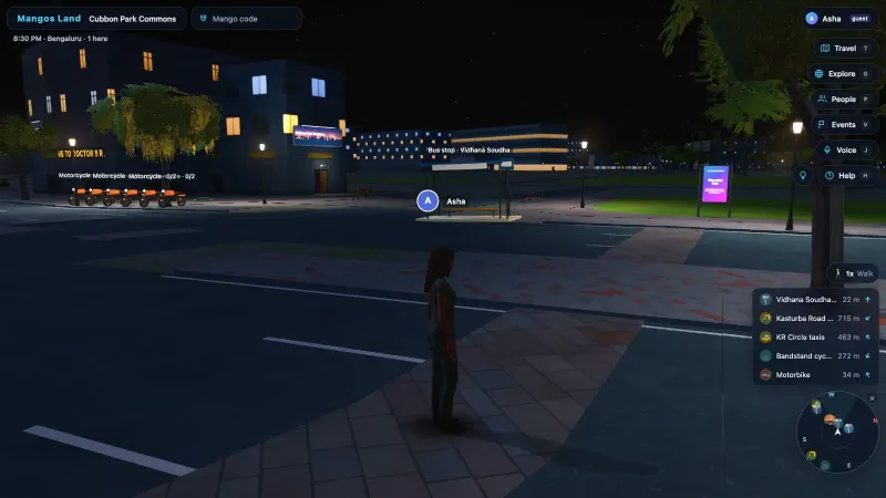
The streets are not photo-real. The map gives a height for few buildings, so most heights are the game's estimate from the kind of building, and every building has game-made walls and windows instead of its real front. Benches, lamps and many of the trees are placed by the game, not copied from the real street.
Where in Bengaluru can I start?
When you open the game, pick one of the 3 start places in Bengaluru, or switch later with Travel:
- Cubbon Park: the park in the middle of the city, and the start place the game picks for you. Walk Cubbon Park in 3D.
- MG Road: the boulevard east of Cubbon Park, with stands for autos, taxis, cycles and motorbikes, and buses towards Indiranagar and Koramangala.
- Palace Grounds: the grounds north of the city centre.
You are not kept inside them. Walk on in any direction and the next streets are built from OpenStreetMap as you reach them.
How do I get around?
- On foot: walk, jog or run.
- By bus: buses run between stops named after real places, such as Majestic Bus Station, Vidhana Soudha and Shivajinagar Bus Station, and you can chat with the people sitting on the same bench as you. The routes are the game's own, not BMTC routes or timetables. A stop called MG Road Metro is only a name: there are no trains.
- By auto or taxi: autos and taxis wait at stands with a driver, who takes you to another start place nearby.
- By cycle or motorbike: take one from a stand and ride it yourself.
Some rides cost a few coins (free account). Buses, autos and taxis charge a fare in Mango coins, so you need a free account (Google sign-in) to ride them, and new accounts start with 100 coins. Cycles and motorbikes cost nothing.
Can I see Vidhana Soudha in 3D?
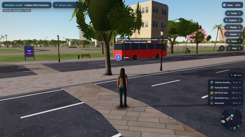
You can walk to Vidhana Soudha and catch a bus at its stop, but the building itself is not drawn yet in the 3D streets you walk.
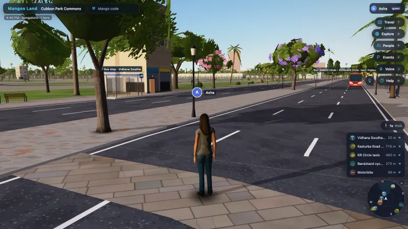
What is there: the Vidhana Soudha bus stop and the wide road it stands on, a motorbike stand close by, and buses on the Majestic – Shivajinagar, Mekhri Circle – Richmond Circle and Cubbon Park – Brigade Road routes.
What is a good first walk?
From where you start to MG Road, with one bus ride:
- Start in Cubbon Park, the place the game picks for you. Have a look at the chai cart and the footballs on the lawn.
- Walk north-west out of the park to the Vidhana Soudha bus stop, a few minutes away. The list of nearby places on your screen shows its direction and distance.
- Wait there for the Cubbon Park – Brigade Road bus and get on (the fare is a few coins). When the next stop is MG Road Metro, choose Get off at MG Road Metro.
- Walk along MG Road. To go back, hire an auto at the MG Road Metro stand and pick Cubbon Park Commons, or use Travel.
How does it compare with Street View and Google Earth?
The Mangos Land column is about the 3D streets you walk in the game.
| Feature | Mangos Land | Google Street View | Google Earth |
|---|---|---|---|
| Walk freely | Yes: walk, run or ride wherever the streets go | No: you step between 360° photos along roads | No: you fly and zoom over a 3D globe |
| Other real people | Yes: everyone else you meet is a real player, apart from service staff | No | No |
| Voice | Yes: talk with the people within about 35 m (free account) | No | No |
| Photo-real | No: the streets are game-style 3D, drawn from map data | Yes: real 360° photos | Yes: satellite and aerial imagery |
| Built from | The streets: OpenStreetMap map data | 360° photos taken along roads | Satellite and aerial imagery on a 3D globe |
Street View and Google Earth show you what a place really looks like. Mangos Land is for walking a city with other people and talking to them. Mangos Land is not made by, endorsed by or affiliated with Google.
Questions people ask
Can I walk around Bengaluru (Bangalore) online in 3D?
Yes, in Mangos Land, free and in your web browser on a phone, tablet or computer. You walk a 3D Bengaluru built from OpenStreetMap as your own character. Guests can look around; sign in with Google (free) to chat, talk by voice and pay fares in coins. You must be 18 or older.
Which parts of Bengaluru are in Mangos Land?
You can start at Cubbon Park, MG Road or Palace Grounds, then walk on: streets further out are built from OpenStreetMap as you reach them. The bus routes and the auto and taxi stands are around Cubbon Park and MG Road.
Is Mangos Land's Bengaluru a photo-real copy?
No. The 3D streets you walk are a game-style city made from OpenStreetMap map data, not from photos. Roads, parks and building outlines follow the map, but most building heights are estimates, buildings have game-made fronts, and some landmarks, such as Vidhana Soudha, are not drawn yet.
How is Mangos Land different from Google Street View or Google Earth?
Google Street View shows 360° photos taken along roads, and Google Earth shows a 3D globe made from satellite and aerial imagery. Neither lets you meet or talk to other people. Mangos Land is a game-style 3D Bengaluru where you walk as a character and chat or talk by voice with the real players near you. Mangos Land is not made by, endorsed by or affiliated with Google.
Can I ride buses and autos in the 3D Bengaluru?
Yes. Buses run between stops named after real places, and autos and taxis wait at stands with a driver. Cycles and motorbikes from a stand are free; some rides cost a few coins (free account). The bus routes are the game's own, not BMTC's.
Walk it yourselfFree in your browser, on a phone or computer. 18+ only.